Google Earth Map
Historic Maps
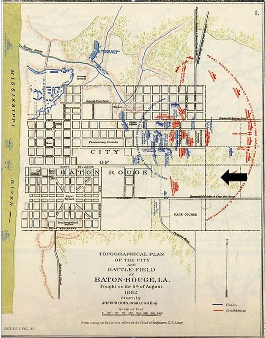
This is a 1862 Civil War map of Baton Rouge, with a black arrow demarcating where Sweet Olive would be later.
Map courtesy of Louisiana Digital Map Library, US Gen Web Archives, http://usgwarchives.org/maps/louisiana/, accessed 12/30/13.
Map courtesy of Louisiana Digital Map Library, US Gen Web Archives, http://usgwarchives.org/maps/louisiana/, accessed 12/30/13.
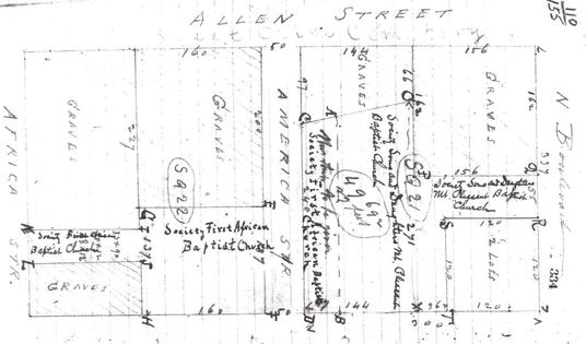
Map showing the legal division of Sweet Olive Cemetery between the two Benevolent Societies.
(Original No 110, Bundle 155, EBR Parish Clerk of Court Office, Baton Rouge, Louisiana).
(Original No 110, Bundle 155, EBR Parish Clerk of Court Office, Baton Rouge, Louisiana).
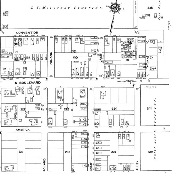
1916 Sanborn map that shows Sweet Olive's proximity to the Baton Rouge National Cemetery.
(Map 19. "Baton Rouge, Louisiana." 1916. Digital Sanborn Fire Insurance Maps, 1867-1970-Louisiana.)
(Map 19. "Baton Rouge, Louisiana." 1916. Digital Sanborn Fire Insurance Maps, 1867-1970-Louisiana.)

1923 Sanborn Map of the cemetery and its surroundings. The buildings in the northeast corner are no longer there.
(Map 49. "Baton Rouge, Louisiana." 1923. Digital Sanborn Fire Insurance Maps, 1867-1970-Louisiana.)
(Map 49. "Baton Rouge, Louisiana." 1923. Digital Sanborn Fire Insurance Maps, 1867-1970-Louisiana.)
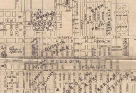
This is an excerpt from the 1929 Map of East Baton Rouge Parish, showing Sweet Olive in the lower left corner and the African American cemetery on Greenwell Springs Road.
There is a cemetery at the 5652 Greenwell Springs Rd area, but I have not found any more information about the cemetery next to Roselawn on this map.
courtesy of East Baton Rouge Parish Library: http://cdm16340.contentdm.oclc.org/cdm/compoundobject/collection/p15196coll4/id/42/rec/11
There is a cemetery at the 5652 Greenwell Springs Rd area, but I have not found any more information about the cemetery next to Roselawn on this map.
courtesy of East Baton Rouge Parish Library: http://cdm16340.contentdm.oclc.org/cdm/compoundobject/collection/p15196coll4/id/42/rec/11
